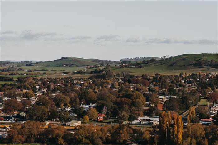
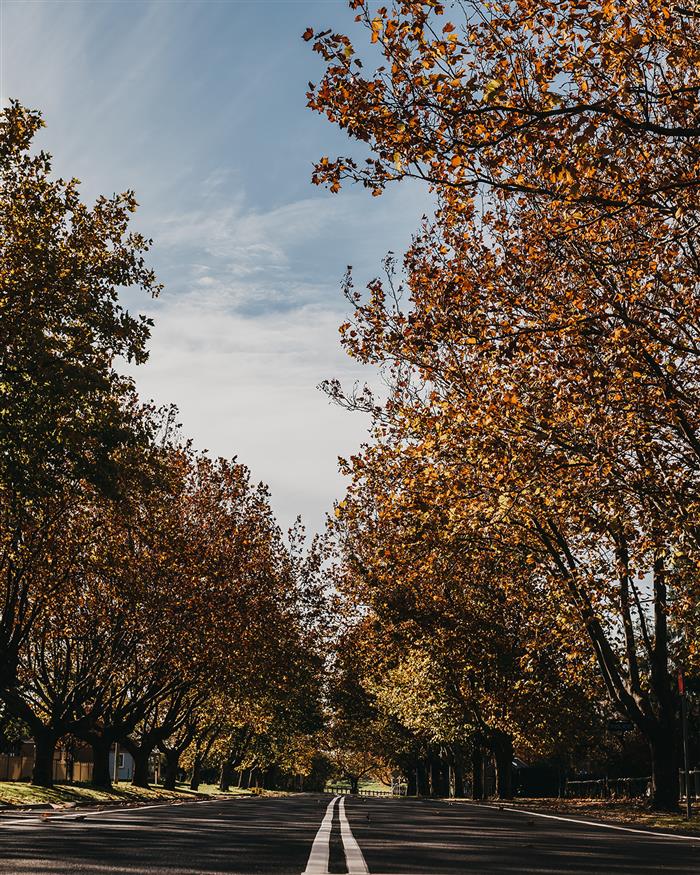
Blayney
The site of Blayney, near the headwaters of the Belubula River, was originally home to the Mucare clan of Wiradjuri people, who were greatly impacted by the arrival of convict overseers with herds of cattle and sheep during the 1820s, which were pastured under license. At about the same time, government surveyors were at work mapping the area. During this time, the name Kings Plains was given to the ground around the Belubula River where a site for a new settlement was surveyed in 1843 and proclaimed as Blayney. However, it wasn't until the construction of the railway through Blayney in 1876 that the town grew. Many of its significant buildings were erected after this time, and reliable and faster transport enabled the establishment of many more businesses.
Various industries have been operational in the town since the 1870s, including flour and chicory mills, a copper mine, meat processing works, a butter factory, pet food production, and a large cold storage facility. In addition, recreational facilities, including parks, a showground, sporting ovals, an indoor pool and an equestrian centre were added during the 20th century for the benefit of residents and visitors.
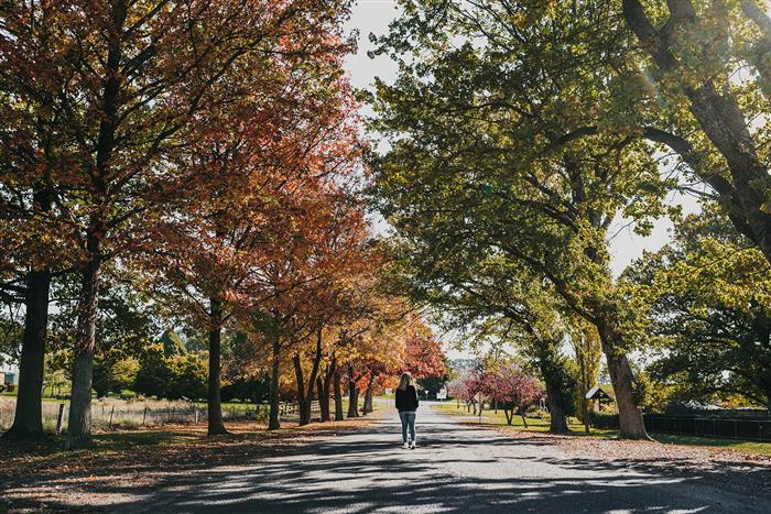
Visitors and residents are encouraged to take the Blayney heritage walk - a self-guided walking tour through Blayney to see its historic buildings, churches and parks.
Download the Blayney brochure
Download the Blayney Heritage Walk brochure
Visit the Orange360 Blayney page here
|
 |
|
The site of Barry village was aset side in 1861, and a school was established the following year. A post office and two churches were erected; stores and a blacksmith business were established. Local agricultural workers took up residence in surrounding streets. Initially called Five Islands, it was in the 1890s that the name Barry came into use. As the streets or Barry are named after clergy or bishops (Barber, Marsden, Hale, Moorhouse, Pearson, Sawyer, Selwyn, Staunton and Turner) it is likely that the name or Barry came from the surname of Bishop Alfred Barry, the third Church of England Bishop of Sydney and Primate of Australia.
Today, all of Barry's public buildings, except St. James Anglican Church, have closed or been re-purposed. The former school is now the local Community Centre. Its village retains much of its original charm with many of its side roads still unsealed.
|
|
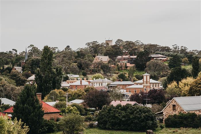
Carcoar
The historic village of Carcoar is nestled in a small sheltered valley beside the meandering Belubula River. Gazetted in 1839 and classified by the National Trust it is the third oldest settlement west of the Blue Mountains and has a picture book quality reminiscent of old England.
The best way to appreciate its treasures is to take a walk through the village where residents have lovingly restored and preserved many of the fine old buildings from the towns heyday in the late nineteenth century.
Stroll around the tree lined streets and view magnificent public buildings, churches and historic homes. Visit the railway station for a bird's eye view of the village. Have a relaxing picnic on the banks of the Belubula River. An interesting range of museums as well as craft, pottery and antique shops, cafes, a nursery and hotel all combine to make the village a popular tourist attraction.
Carcoar is indeed one of Australia's historic gems.
In 2022 Carcoar was named the Top Tourism Town of NSW for a population under 1,500.
Download the Carcoar brochure
Visit the Orange360 Carcoar page here
|
 |
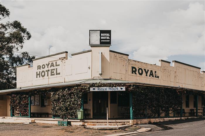
Lyndhurst
Today, it is difficult to imagine that Lyndhurst was once on a short-list of sites for the national capital, however, owing to the changing nature of the mining industry, the town has undergone many changes in fortune both ups and downs.
As the closest centre to the rich Lyndhurst Goldfields, also now known as the Junction Reefs, the town prospered during the late 1800's and at one stage boasted three banks, three general stores, a cinema, a pub, professional photographer, farrier, baker, fruit shop, butcher, three garages, railway station, a memorial hall and showground.
The fourth Prime Minister of Australia, George Reid, described Lyndhurst as "a magnificent location for the capital". It already had a large dam on the nearby Belubula River that could easily service the capital.
But it wasn't to be, with Canberra chosen. Although it is a shadow of its former self; Lyndhurst owes a lot to the existence of a large mining company at the Junction Reefs site. The Royal Hotel is still thriving with another popular spot in the town being the Lyndhurst Post Office and Takeaway in the old bakery building. Lyndhurst also boasts a golf club.
Nearby Junction Reefs is one of nature's gifts, not only to Lyndhurst and Mandurama but to the entire Central West, where the Belubula River has carved out a spectacular gorge complete with waterfalls and quiet water holes. Previous mining operations have also left a rich mining heritage, including the impressive dam which has now silted up.
Download the Lyndhurst brochure
Visit the Orange360 Lyndhurst page here
|
 |
| Mandurama
The name of Mandurama Farm was initially used by the first settler, Thomas Icely, and was noted as a colonial town in 1829. However, the village as it exists now was only surveyed in 1875 when Thomas Icely Jr., after opening nearby land for gold mining and needed to provide a base for miners and others, then engaged a surveyor to lay out a village. He named the streets after either metals or fruits. The village later had its own railway station after the construction of a southern line from Blayney. Like other villages on the line it was closed when the government of the day closed the route. Only the platform remains.
While ever the gold was available, Mandurama prospered. On its decline, it became a service centre for the surrounding rich agricultural area, a role aided by its location on the busy Mid-Western Highway.
Evidence of the town's importance can be seen by the fine old buildings, including the magnificent Royal Hotel, Masonic Hall, churches and bank premises. There is a mix of architectural styles in the village, which also boasts an impressive park and a number of businesses servicing highway travelers.
Download the Mandurama Brochure
Visit the Orange360 Mandurama page here |
 |
|
Millthorpe Village boasts award winning restaurants, arts and antiques, a museum, boutique shops, hotels, wine tasting and accommodation enhancing its charm, sophistication and eclectic style.
Located in Central NSW, Millthorpe Village is 3.5 hours from Sydney and Canberra, 30 minutes from Bathurst and 20 minutes from Orange, in the heart of a dynamic food and cool climate wine region, a centre for truffle production, and home to a vibrant community of local artists with a diverse range of talented people living and working in the village.
Established in the pioneering era, Millthorpe has a rich agricultural history, a legacy of grand buildings, heritage architecture and a streetscape that has remained largely unchanged since the early 1900’s. The entire village is classified by the National Trust and the village centre has cobbled, bluestone bordered streets. Millthorpe is a living museum being home to a community of about 700 people and comes alive on weekends with locals, visitors and tourists alike.
Millthorpe is set in a rural landscape amongst gently rolling hills with Mount Canobolas in the distance a majestic backdrop. At 965m above sea level Millthorpe’s elevation ensures a distinct four seasons experience. Winter sees cold nights and open fires with frosty mornings and snowfalls, spring brings green blossoming countryside with crisp nights, summer is a time of outdoor entertaining under magical starry skies and autumn delivers a spectacular display of colour. With such a rich heritage and seasonal climate, fabulous food, wine and wonderful people it’s always a great time to visit Millthorpe.
Take a step back in time, spend some time at the museum, take a stroll around the streets of Millthorpe and experience a place where horse and cart were tethered to verandah posts, locals chat on street corners and children play in the streets. Relax, unwind and soak up the beauty and elegance of a bygone era.
Download the Millthorpe Village Brochures here
Visit the Millthorpe Village website here
Visit the Orange360 Millthorpe Page here
|
 |
|
Tucked away in a quiet corner of Blayney Shire, away from the highway traffic but retaining a proud sense of heritage and community spirit is Neville.
Neville today boasts a population of about 100, who all care a great deal about their town and its facilities. There is enthusiastic interest in a range of pursuits including sport, the rural bushfire brigade, church, the Public School and other projects like the Memorial Park and Community Hall. The Village Enhancement Plan for Neville sets-out proposed community improvements for the Village.
The hotel is a popular meeting place and Neville Siding Accommodation Units provide a comfortable place to stay for visitors from far and wide. The Neville Siding Units feature the redundant Mandurama Railway Station and railway goods vans from 1950-1970. Neville is features on the Orange and Villages Bicycle Trail with Neville Siding becoming a popular stop over for cyclists.
Neville is the closest Blayney Shire village to the popular natural wonderland at Abercrombie Caves.
Download the Neville Village Brochure
Visit the Orange360 Neville page here
|
 |
|
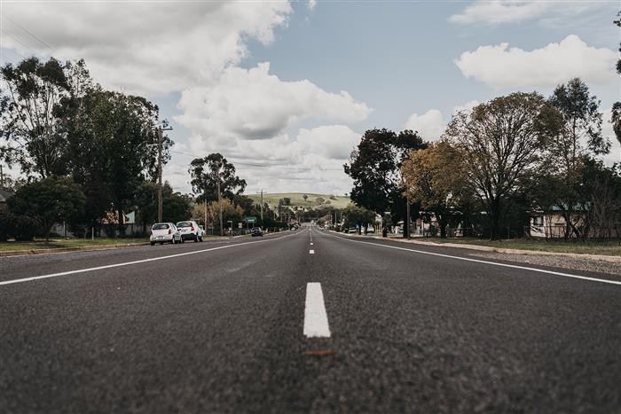
Until the construction of the western railway line in 1876, the area had only been used for agricultural purposes and was initially known as either Back Creek or Reedy Creek. It was eventually renamed Newbridge in 1878, after the building of a bridge over the railway line. The name could have had Irish origins, as there were a significant number of Irish residents, and simply came from the railway bridge. Like other railway stations it became a busy centre, particularly for the transport of livestock to market.
A highlight for the community was that the Royal Train carrying Queen Elizabeth II and the Duke of Edinburgh stopped overnight in the railway yards during the Royal Visit of 1970.
The town has a local pub and restaurant serving modern cuisine. There is a village craft shop, art gallery, playground, tennis courts, picnic area with electric BBQ and amenities. Visitors are welcome for free camping (donation accepted!) at the local sportsground.
Newbridge Village Brochure
Visit the Orange360 Newbridge page here
|
Photos by Angus McKern
|